NAVFAC Washington District Sampling and Analysis of Industrial Facilities Discharges, Mapping/Investigation of Infrastructure, PAX River, NAS and JBAB Washington, D.c.
Back to ProjecTs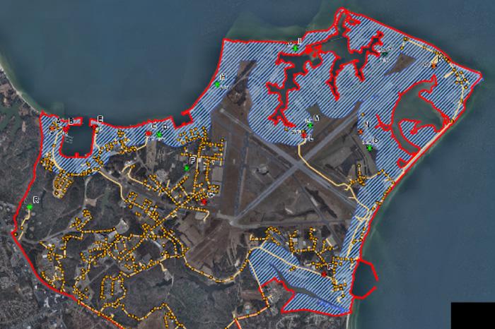
Project Description
This project was implemented to comply with various DOD environmental requirements and the local Chesapeake Bay water compliance intiatives.
This project included approximately $650,000 in engineering fees (2013-2015) that covered an area of 7,900 acres of Pawtuxent River Naval Air Station (PAX NAS) and Joint Air Force Base Anacostia Bolling (JBAB). CEI worked with multiple DoD protocols, coordinating parties, and performed work in high security areas. The work was done as a subcontract to the Veteran Owned Small Business TK&K on a Navy IDIQ contract.
CEI had two main tasks: 1) the updating of an Industrial Waste Management and Pretreatment (IWMP) program for PAX and 2) the mapping of storm drainage on both PAX and JBAB. The second component also involved assisting a TV crew in viewing storm drains so that repairs could be made, but it turned out that much of the base was inaccessible to the TV truck. As a result, CEI innovatively used a light weight high accuracy remote extension camera that our crews used to TV the areas that were inaccessible to the TV truck. Many of these were on the active runway used for testing aircraft, so there was further coordination with the fire crews stationed at the runways since escorts were required.
IWMP Program: CEI’s role was to investigate industrial wastewater discharges on PAX River NAS in accordance with: OPNAVINST 5090.1C, National Pretreatment Standards (40 CFR403), the Federal Facilities Compliance Act of 1992, COMAR 28.08.08, the Public Sewer Use Regulation of St. Mary’s County, and the Pretreatment Permit issued by the St. Mary’s County Metropolitan Commission, EPA Industrial Wastewater Management Program. CEI then worked with NAVFAC to update their Industrial Wastewater Management Plan (IWMP) for Naval Air Station Patuxent River, Maryland (NASPR) and assess septic systems for compliance. The PAX River portion of the NASPR consists of over 500 manholes and >150,000 linear feet of sanitary sewer pipes. In 1998, the IWMP noted 100 Significant Industrial Users (SIUs)/Industrial Users (IUs). CEI identified locations that required pretreatment or appropriate management controls using Industrial Discharge Certificates (IDCs) and identified monitoring procedures to demonstrate compliance with these pretreatment standards. CEI created a Preventative Maintenance Plan for each major component in the collection system (i.e., lift/pump station, pretreatment unit, flow meter). CEI field tested connections to septic systems via dye testing to determine active or abandoned status.
Mapping & Camera Work: This portion of the work involved storm drain mapping of the two bases using the Navy’s GPS standard to 0.3 cm accuracy and GIS /Database protocol SDSFIE 2.6. CEI mapped and investigated the bases to update the Navy’s Geographical Information System (GIS) according to their protocols and to assess the integrity of pipes crossing the runways and other drainage features, including site surveys and data collection to map the storm sewer system. The field survey identified key attributes such as the location of all drainage structures, pipe size, material and length. Other features cataloged included Best Management Practices (BMP) structures, receiving water, flow direction, culverts, open drainage (i.e. swales, ditches, and detention ponds), catch basins, outfalls, inlets, and any off-base pipes that pass through the base to the Potomac or Anacostia Rivers, and a general description of each facility condition. Overall, CEI located over 1500 inlet structures, catch basins, BMP’s, oil water separators, culverts, ditches, and/or outfalls in a period of only 150 working days.
